For planning, design, and site screening.
Instantly download clean, geo-referenced CAD files.
Freehold boundaries, basemaps, Flood Map for Planning, and 1 m topographic contours.
Ready to use in DWG format.
For appraisal, planning, engineering, and design.
Ready to use DWG files, OS Grid-referenced.
Built from Ordnance Survey OpenData, Environment Agency, NRW, and LiDAR datasets.
Drop straight into CAD.
Everything you need to get started with your next project.

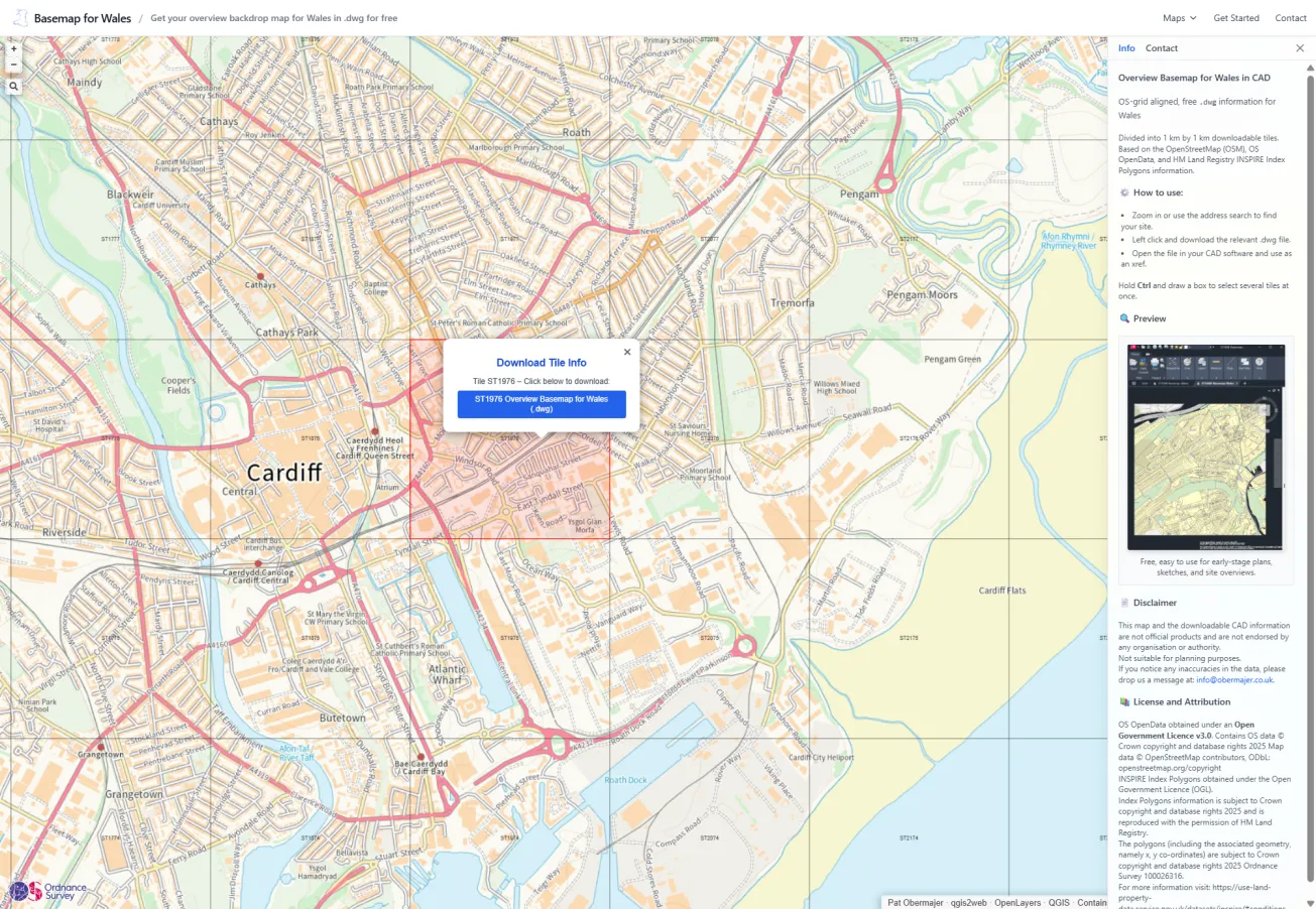
Overview basemap designed for general location plans and context, showing buildings, roads, and water features. Ideal for larger areas at the appraisal stage and for site context plans.
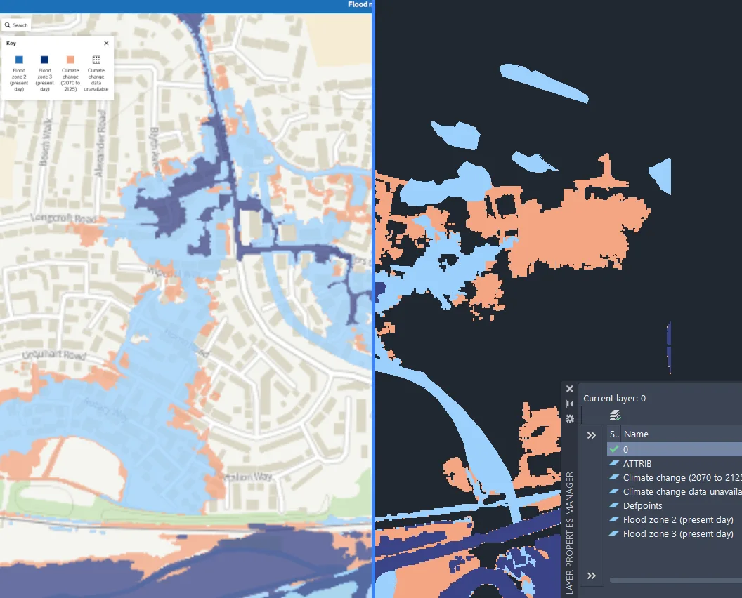
Flood Zones plus climate change for England based on the EA dataset in DWG format.
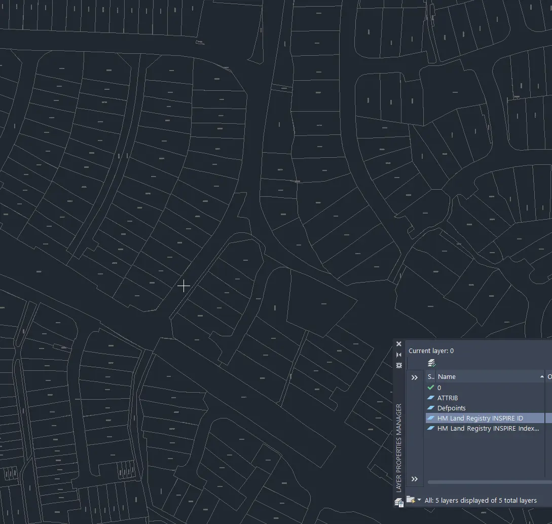
HM Land Index Registry Polygons for England, Wales, and Scotland. The dataset shows the location and indicative extent of freehold registered land and property. In DWG format.
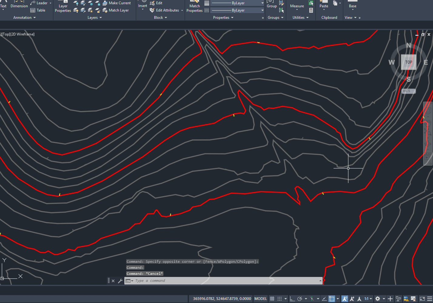
Topographic contours at 1 m interval for England in DWG format for early stage purposes.
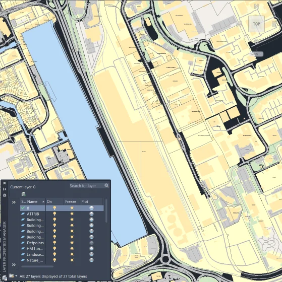
Overview background mapping ideal for preliminary drawings and location plans, sourced from OpenStreetMap, OS OpenData, and HL Land Boundaries.
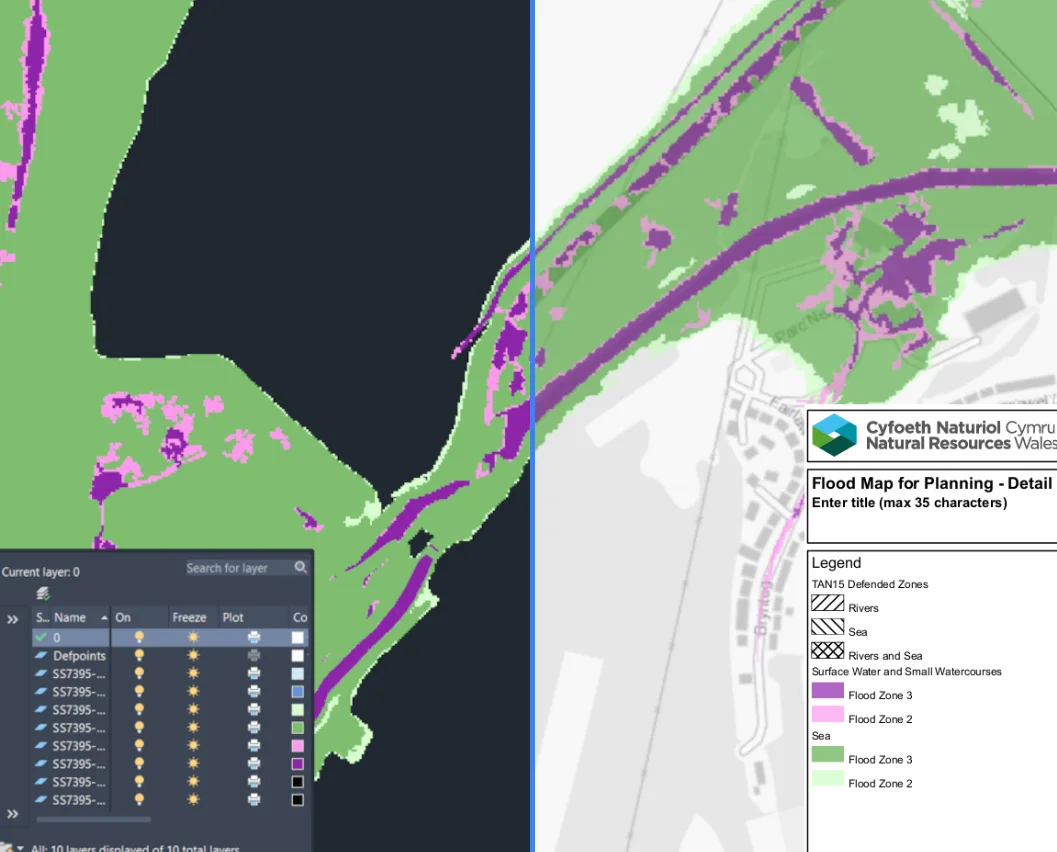
Get the DWG Flood Map for Planning information for Wales reproduced from the NRW dataset.
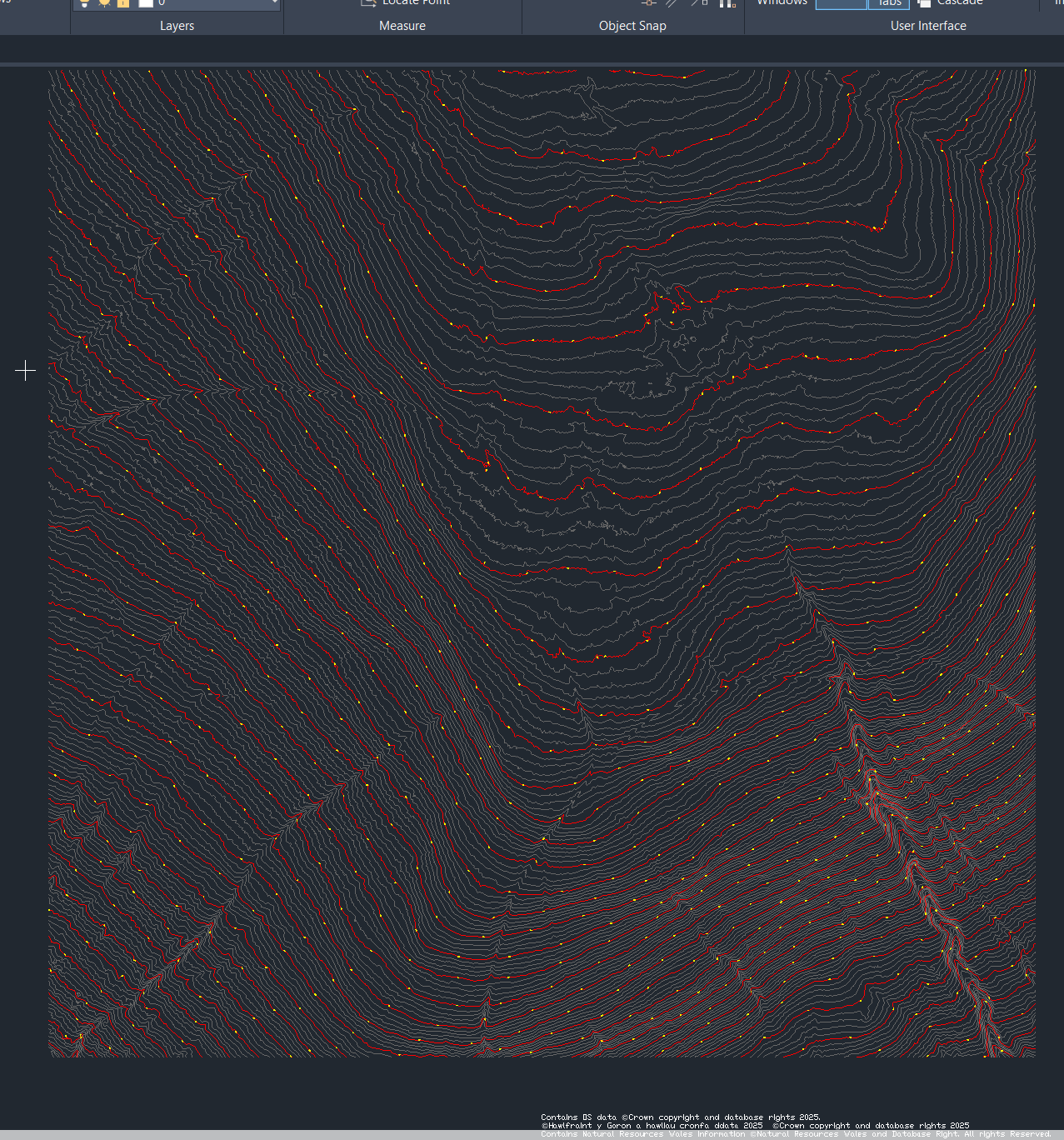
Precision topography derived from LiDAR DTM bare Earth data, perfect for engineering and environmental applications. Now in DWG.
Get notified about new features, datasets & launches.
You’ve joined the list.
Everything is built from open datasets under permissive licences, so yes.
DWG format, compatible with AutoCAD and other CAD tools. Aligned to OS grid and set BYLAYER.
Our Basemap is created from open data sources, including OpenStreetMap, various OS OpenData products, and HM Land Registry boundaries. These data sets are combined to produce our own map drawings.
OS MasterMap, on the other hand, is Ordnance Survey’s most detailed and proprietary mapping product. It is only available through their Licensed Partners.